Comarca de Pamplona
Innovative real-time services for underground networks management
The aim of the pilot is to work with the integration of real-time data for the improvement of the water management.
Other target of this pilot is to show the capabilities of GIS systems as the best tool, to manage, to monitor and to exploit real-time information. The data could be cross nearer to physical reality, could be interoperated in a geographical context, and the decisions could be applied over ways or regions with a more general meaning.
The ultimate purpose is to facilitate analysis and decision-making information from a hydrographic model. It provide services that help in management of the complexity of the underground networks. These services coordinate the activities to be performed on water networks and provide all relevant data to be available geographically in the context of the pilot.
Beyond the search for efficiency in service coordination and management of hydrographic information, the pilot jumps another step towards the inclusion of geographic information layers in real time, which was one of the requirements of the end user.

Thus, in addition to a coordinated network to exploit data and facilitate the analysis and decision-making, the pilot offer the possibility to query the current state of diverse aspects of the pipelines, optimizing the preventive and corrective proceedings, even including pipe systems not directly related to the incident, or planned sensors along the network.
To achieve this objective the pilot uses and integrates data of the supply and treatment of water network, collected through sensors installed along its infrastructure. With this information, and by means of a suitable geoprocessing, we may provide a set of services that will help to manage and to simulate underground infrastructures of the Region of Pamplona.

Functionality
The pilot control and display the following geographic information:- SCADA sensor network, made up of chlorimeters and flowmeters
- EPANET network, local organization supply network
- Supply and Sanitation Network according to the GeoSmartCity - INSPIRE data model.
- Present real-time information of the same type sensors
- Compare the data in real time with simulation values and historical values.
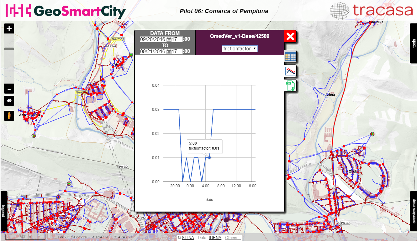
- Obtain the information of all the observable sensor properties in a point and gives the possibility to filter by dates, to show a graph, to export to Excel, etc .
Access the application
Interested?
GeoSmartCity Hub components used
Training Material
 Learn more by following this presentation in our eLearning platform.